

History
History of Taal
Taal Volcano is part of a chain of volcanoes along the island of Luzon, which were formed by two tectonic plates colliding over 500,000 years ago. Since the formation of this large caldera (Taal Lake), subsequent eruptions created another volcanic island, within Taal Lake, known as Volcano Island.
Over thirty eruptions have been recorded at Taal since the 16th century, mostly small eruptions restricted to Volcano Island. However, occasional violent activity has affected the entire region with the death toll estimated at over 5000 people. Because of its proximity to populated areas and its eruptive history, Taal Volcano was designated a Decade Volcano.
Volcano Island (in Lake Taal)
Taal Volcano is the smallest active volcano in the world. Its unexplained shape and location on an island within a lake within an island, makes it a unique geologic wonder, enthralling thousands of tourists and geologists yearly. This island covers an area of about 23 km², and consists of forty-seven different overlapping cones and craters. It is one of the active volcanoes in the Philippines and part of the “Pacific Ring of Fire”.
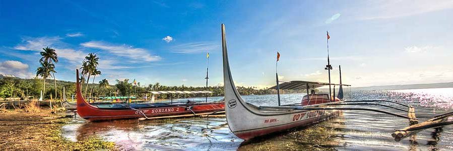
Permanent settlement in the island is prohibited by the government. Despite the warnings, poor families have settled on the island, risking their lives, earning a living through tourism, fishing and farming crops from the rich volcanic soil.
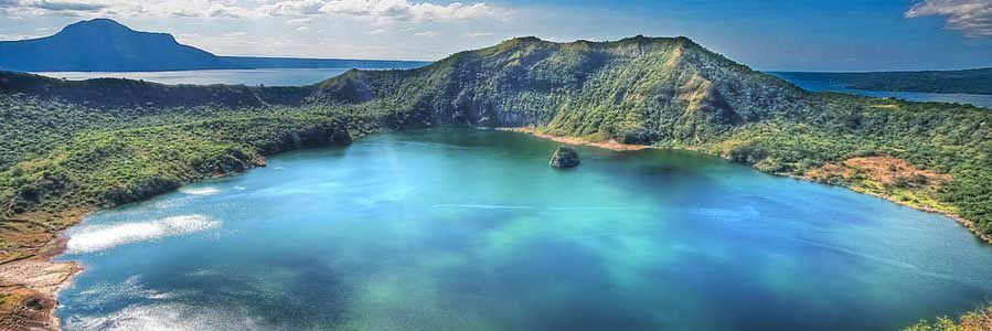
Crater Lake (on Volcano Island)
The lake’s water is a diluted form of sulphuric acid with high concentration of boron, magnesium, aluminium and sodium in salt form. Its average depth measures 20m. Swimming is allowed in the lake.
Vulcan Point (an island in the Crater Lake on Volcano Island in Lake Taal)
In 1911 a devastating eruption claimed over a thousand lives. The deposits of the eruption drastically changed the floor of the main Crater Lake creating Vulcan Point. Vulcan Point is the world’s largest island within a lake on an island within a lake on an island. (An island in the Crater Lake on Volcano Island in Lake Taal on the island of Luzon)
Lake Taal (freshwater lake)
Lake Taal is a large freshwater lake with a high sulphuric content. In the 18th century large eruptions sealed Taal Lake from the sea, eventually leading its waters to become non-saline. The lake is only 2.5 metres above sea level and its surface area measures over 230 square kilometres. The lake is fed by over 30 rivers but has only one outlet, the Pansipit River which drains into Balayan Bay in the South China Sea.
For decades Taal Lake has been used and abused by local communities, to its detriment. Most of the abuse has been in the form of overfishing and exploitation, with the deployment of fish cages for aquaculture-profit. With the ever increasing scarring of the mountainsides and valleys for housing projects, the removal of the forests and the pollution of the rivers and streams that feed the Taal Lake, are now Taal Lake’s greatest enemies.
Pansipit River (sole drainage outlet of Taal Lake)
The Pansipit River is the sole drainage outlet of Taal Lake. The river has a very narrow entrance at Lake Taal and stretches nine kilometres before emptying into Balayan Bay. The lake’s freshwater population of giant trevally conduct its annual migration run through the river. At one time, more than 80 different species of fish were found to inhabit the river’s waters, either as a migratory channel or as a permanent residence. This once included Taal Lake’s now-extinct population of bull sharks.
The construction of fish cages has long been a problem for the river’s natural ecology. Fish cages, oftentimes spanning the width of the entire river; physically block the natural migratory paths of fish species that move between the lake and the sea. Over the years, numerous measures have been attempted to curb the growing number of illegal fish cages in the river.